
tóng-àn:Illinois Locator Map.PNG
Bô khah koân ê kái-sek-tō͘.
Illinois_Locator_Map.PNG (288 × 405 siōng-sò͘ , tóng-àn chiàm-liōng: 12 KB, MIME luī-hêng: image/png)
|
|
Che sī tùi Wikimedia Commons ín--lâi ê chi̍t hūn tóng-àn. I tī hia ê kì-su̍t-ia̍h téng-bīn ê chu-sìn hián-sī ùi ē-té. |

|
本圖片是以PNG、GIF或JPEG格式上傳。然而,其中包含的資料或訊息,應該重新建立成可縮放向量圖形(SVG)檔案,以更有效率或更準確的方式儲存。如有可能,請上傳本圖片的SVG格式版本。在上傳之後,請修改維基各姊妹計畫中所有使用舊版圖片的條目(列在圖像連結章節中),替換為新版圖片,並在舊圖片的描述頁中加入{{Vector version available|新圖片名稱.svg}}模板,同時移除本模板。
|
Khài-iàu
Siū-khoân
I, Ruhrfisch,此作品的版權所有人,決定用以下授權條款發佈本作品:

|
Siū-khuân hōo lí i-tsiàu Tsū-iû Nńg-thé Ki-kim-huē huat-pòo ê bô kòo-tīng bûn-jī, hong-bīn bûn-jī kah hong-té bûn-jīGNU Tsū-iû Bûn-kiānn Siū-khuân Tiâu-khuán1.2 pán ia̍h-sī koh-lâi ê jīm-ì pán-pún, tuì pún tóng-àn tsìn-hîng hok-tsè, thuân-pòo, kah/ia̍h-sī siu-kái.Tsit-ê hia̍p-gī ê hù-pún khǹg tī GNU Tsū-iû Bûn-kiānn Siū-khuân Tiâu-khuán tang-tiong. |
| Tsit-ê tóng-àn sī iōng Tshòng-iōng CC Kâng-khuán hong-sik hun-hióng 3.0 bī tsāi-tuē pán-pún siū-khuân tiâu-khuán. | ||
Piau-sī miâ-sìnn:
I, Ruhrfisch | ||
| ||
| 已新增授權條款標題至此檔案,作為GFDL授權更新的一部份。 |
此檔案採用創用CC 姓名標示-相同方式分享 2.5 通用版授權條款。
Piau-sī miâ-sìnn:
I, Ruhrfisch
- Lí ē-sái tsū-iû:
- hun-hióng – kho͘-pih, hoat-pò͘ kap thoân-pò͘ pún chok
- tiông-sin siu-kái – kái-pian pún chok-phín
- Àn i-hā ê tiâu-kiāⁿ
- Piau-sī miâ-sìnn – Lí ài siá-bîng tsìng-khak ê miâ-hō, ū siū-khuân tiâu-khuán ê liân-kiat, iáu-koh-ū lí tsuè siánn-mih ê kái-piàn. Lí ē-tàng tī jīm-hô ha̍p-lí ê hong-sik tsìn-hîng, m̄-kò buē-tàng ti̍t-tsiap kóng siū-khuân hōo lí ia̍h-sī lí sú-iōng.
- Kâng-khuán hong-sik hun-hióng – Lí nā kái-tōng, piàn-khoán, he̍k-chiá kun-kù pún chok chhòng-chō, lí kaⁿ-taⁿ ē-tàng ēng kap pún chok kâng-khoán he̍k-chiá saⁿ-chhiūⁿ ê hí-khó lâi hoat-pò͘ chò--chhut-lâi ê chok-phín.
Lí ē-tàng suán-ti̍k lí su-iàu ê siū-khuân tiâu-khuán.
This image or file is a work of a United States Census Bureau employee, taken or made as part of that person's official duties. As a work of the U.S. federal government, the image is in the public domain.
|
 |
Tóng-àn le̍k-sú
Chhi̍h ji̍t-kî/sî-kan, khoàⁿ hit sî-chūn--ê tóng-àn.
| Ji̍t-kî/Sî-kan | Suè-tiunn-tôo | Tshùn-tshioh | Iōng-chiá | Chù-kái | |
|---|---|---|---|---|---|
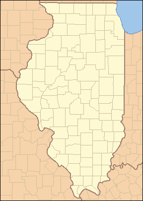
| hiān-chāi | 2007 nî 4 goe̍h 25 ji̍t (pài-saⁿ) 04:02 | | 288 × 405(12 KB) | Ruhrfisch | {{Information| |Description= Locator Map of Illinois, United States |Source= taken from US Census website [http://factfinder.census.gov/] and modified by User:Ruhrfisch |Date= March 2007 |Author= US Census, Ruhrfisch |Permission= US Census / US Gover |
| 2007 nî 3 goe̍h 28 ji̍t (pài-saⁿ) 03:45 |  | 288 × 405(13 KB) | Ruhrfisch | {{Information| |Description= Locator Map of Illinois, United States |Source= taken from US Census website [http://factfinder.census.gov/] and modified by User:Ruhrfisch |Date= March 2007 |Author= US Census, Ruhrfisch |Permission= US Census / US Gover | |
| 2007 nî 3 goe̍h 28 ji̍t (pài-saⁿ) 03:12 |  | 242 × 412(11 KB) | Ruhrfisch | {{Information| |Description= Locator Map of Illinois, United States |Source= taken from US Census website [http://factfinder.census.gov/] and modified by User:Ruhrfisch |Date= March 2007 |Author= US Census, Ruhrfisch |Permission= US Census / US Gover |
Iáⁿ-siōng liân-kiat
Bô poàⁿ ia̍h liân kàu chit tiuⁿ iáⁿ-siōng.
tóng-àn hō͘ lâng sái--ê chōng-hóng
Ē-kha--ê kî-thaⁿ wiki ēng tio̍h chit--ê tóng-àn:
- ar.wikipedia.org hō͘ lâng ēng--ê chêng-hêng
- ceb.wikipedia.org hō͘ lâng ēng--ê chêng-hêng
- de.wikipedia.org hō͘ lâng ēng--ê chêng-hêng
- en.wikipedia.org hō͘ lâng ēng--ê chêng-hêng
- Saint Valentine's Day Massacre
- List of counties in Illinois
- List of protected areas of Illinois
- User talk:Kranar drogin/Archive 2
- Template:State parks of Illinois map
- File talk:Illinois Locator Map.PNG
- User talk:Kranar drogin/Archive 3
- Wikipedia talk:WikiProject Illinois/Archive 3
- User:Ruhrfisch
- User:Escatel1/article notes
- Template:Illinois County Labelled Map
- Module:Location map/data/USA Illinois inset/doc
- Module:Location map/data/USA Illinois inset
- User:Blåmerke
- fa.wikipedia.org hō͘ lâng ēng--ê chêng-hêng
- فهرست شهرستانهای ایلینوی
- الگو:Geobox locator Illinois
- بیردزتاون (ایلینوی)
- بلویل (ایلینوی)
- بلویدر (ایلینوی)
- بلومینگتون (ایلینوی)
- بربنک (ایلینوی)
- کانتون (ایلینوی)
- کاربوندیل (ایلینوی)
- کارتج (ایلینوی)
- شمپین (ایلینوی)
- چنوآ (ایلینوی)
- کلینزویل (ایلینوی)
- کیوبا (ایلینوی)
- فریپورت (ایلینوی)
- جلینا (ایلینوی)
- گرانیتسیتی (ایلینوی)
- گرینویل (ایلینوی)
- هاروی (ایلینوی)
- لانرک (ایلینوی)
- لارنسویل (ایلینوی)
- لاوز پارک (ایلینوی)
- مارنگو (ایلینوی)
- مونتکارول (ایلینوی)
- مونتاسترلینگ (ایلینوی)
Khuànn tsit-ê tóng-àn ê koh-khah-tsuē tsuân-i̍k sú-iōng.