
Scheßlitz
Scheßlitz | |
|---|---|
 Town center of Scheßlitz with the Church of Saint Kilian | |
 Coat of arms | |
Location of Scheßlitz within Bamberg district  | |
 Scheßlitz  Scheßlitz | |
| Coordinates: 49°58′30″N 11°2′00″E / 49.97500°N 11.03333°E | |
| Country | Germany |
| State | Bavaria |
| Admin. region | Oberfranken |
| District | Bamberg |
| Subdivisions | 30 Stadtteile |
| Government | |
| • Mayor (2020–26) | Roland Kauper[1] (CSU) |
| Area | |
| • Total | 94.88 km2 (36.63 sq mi) |
| Elevation | 310 m (1,020 ft) |
| Population (2024-12-31)[2] | |
| • Total | 7,129 |
| • Density | 75/km2 (190/sq mi) |
| Time zone | UTC+01:00 (CET) |
| • Summer (DST) | UTC+02:00 (CEST) |
| Postal codes | 96110 |
| Dialling codes | 09542 |
| Vehicle registration | BA |
| Website | www |
Scheßlitz (or Schesslitz; Main-Franconian: Schääz) is a town in the Upper Franconian district of Bamberg and is on the rise to the Franconian Switzerland on the A 70 between Bamberg and Bayreuth, being 14 km northeast of the former.
References
[change | change source]- ↑ Liste der ersten Bürgermeister/Oberbürgermeister in kreisangehörigen Gemeinden, Bayerisches Landesamt für Statistik, 15 July 2021.
- ↑ "Gemeinden, Kreise und Regierungsbezirke in Bayern, Einwohnerzahlen am 31. Dezember 2024; Basis Zensus 2022" [Municipalities, counties, and administrative districts in Bavaria; Based on the 2022 Census] (CSV) (in German). Bayerisches Landesamt für Statistik.
Further reading
[change | change source]- Matthias Wolf: Das Schäätzer Bockäla. Schweinfurt, Verlag Wolfgang Bleiweis, 1992. ISBN 3-928786-13-X
Other websites
[change | change source]Wikimedia Commons has media related to Scheßlitz.
Picture gallery
[change | change source] Hauptstraße
 Elisabethen-Kirche
 Former Elisabethenspital (hospital)
 Old Town Hall
 Kilians-Eiche (oak)
 Brewery
 View from the Giechburg
 Gügel chapel
 Chapel in Ehrl
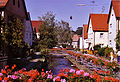 Ehrl
Ehrl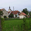 Schweisdorf
 St.Martin Weichenwaserlos
 Quarry near Ludwag


| International | |
|---|---|
| National | |
| Geographic | |