Portal:Tropical cyclones
The Tropical Cyclones Portal

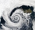
A tropical cyclone is a storm system characterized by a large low-pressure center, a closed low-level circulation and a spiral arrangement of numerous thunderstorms that produce strong winds and heavy rainfall. Tropical cyclones feed on the heat released when moist air rises, resulting in condensation of water vapor contained in the moist air. They are fueled by a different heat mechanism than other cyclonic windstorms such as Nor'easters, European windstorms and polar lows, leading to their classification as "warm core" storm systems. Most tropical cyclones originate in the doldrums, approximately ten degrees from the Equator.
The term "tropical" refers to both the geographic origin of these systems, which form almost exclusively in tropical regions of the globe, as well as to their formation in maritime tropical air masses. The term "cyclone" refers to such storms' cyclonic nature, with anticlockwise rotation in the Northern Hemisphere and clockwise rotation in the Southern Hemisphere. Depending on its location and intensity, a tropical cyclone may be referred to by names such as "hurricane", "typhoon", "tropical storm", "cyclonic storm", "tropical depression" or simply "cyclone".
Types of cyclone: 1. A "Typhoon" is a tropical cyclone located in the North-west Pacific Ocean which has the most cyclonic activity and storms occur year-round. 2. A "Hurricane" is also a tropical cyclone located at the North Atlantic Ocean or North-east Pacific Ocean which have an average storm activity and storms typically form between May 15 and November 30. 3. A "Cyclone" is a tropical cyclone that occurs in the South Pacific and Indian Oceans.
Selected named cyclone -
Hurricane Edith was the strongest hurricane to form during the 1971 season, becoming a Category 5 hurricane on the Saffir-Simpson scale. Edith developed from a tropical wave on September 5 and quickly strengthened into a hurricane in the Caribbean Sea. Edith rapidly intensified on September 9 as it approached Central America, and it made landfall on Cape Gracias a Dios as a Category 5 hurricane, with sustained winds of 160 mph (260 km/h). It quickly lost strength over Central America, and after briefly entering the Gulf of Honduras, Edith struck Belize as a strong storm. It crossed the Yucatán Peninsula and moved across the Gulf of Mexico, approaching but remaining just offshore Tamaulipas. A trough turned the storm to the northeast, and Edith restrengthened into a hurricane, making its final landfall on Louisiana with winds of 105 mph (170 km/h) on September 16. Edith steadily weakened over land and dissipated over Georgia on September 18.
The hurricane killed two people when it passed near Aruba. Striking northeastern Central America as a Category 5 hurricane, Edith destroyed hundreds of homes and killed at least 35 people. In Texas, high tides caused coastal flooding but little damage. Edith caused moderate to heavy damage in portions of Louisiana due to flooding and a tornado outbreak from the storm. One tornado, rated F3 on the Fujita Scale, damaged several homes and injured multiple people in Baton Rouge. The tornado outbreak extended eastward into Florida, of which a few destroyed entire buildings. Damage in the United States totaled $25 million (1971 USD). (Full article...)
Selected article -

The history of Atlantic tropical cyclone warnings details the progress of tropical cyclone warnings in the North Atlantic Ocean. The first service was set up in the 1870s from Cuba with the work of Father Benito Viñes. After his death, hurricane warning services were assumed by the US Army Signal Corps and United States Weather Bureau over the next few decades, first based in Jamaica and Cuba before shifting to Washington, D.C. The central office in Washington, which would evolve into the National Meteorological Center and the Weather Prediction Center, assumed the responsibilities by the early 20th century. This responsibility passed to regional hurricane offices in 1935, and the concept of the Atlantic hurricane season was established to keep a vigilant lookout for tropical cyclones during certain times of the year. Hurricane advisories issued every 12 hours by the regional hurricane offices began at this time.
The National Hurricane Center became a tropical cyclone warning center in 1956 and assumed many of the functions it has today by 1965. The National Hurricane Research Project, begun in the 1950s, used aircraft to study tropical cyclones and carry out experiments on mature hurricanes through its Stormfury project. Forecasts within the hurricane advisories were issued one day into the future in 1954 before being extended to two days into the future in 1961, three days into the future in 1964, and five days into the future in 2001. From the 1960s through the 1980s, work from the various regional hurricane offices was consolidated into the National Hurricane Center. Its name was changed to the Tropical Prediction Center in 1995, before reassuming its National Hurricane Center name in 2010. Tropical cyclone forecasting is done nowadays using statistical methods based on tropical cyclone climatology, as well as methods of numerical weather prediction where computers use mathematical equations of motion to determine their movement. (Full article...)
Selected image -

Selected season -

The 1998 Pacific hurricane season was a fairly average Pacific hurricane season. Despite this, it had nine hurricanes and six major hurricanes, which was well above average. The season officially started on May 15 in the eastern Pacific and on June 1 in the central Pacific, and ended on November 30; these dates conventionally delimit the period during which most tropical cyclones form in that region. The first tropical cyclone developed on June 11, about ten days later than the normal start of the season. The final storm of the year, Hurricane Madeline, dissipated on October 20. Storm activity in the Central Pacific Hurricane Center's warning zone was low, with just one tropical depression observed in the region. Two tropical cyclones from the eastern Pacific (Darby and Estelle) also entered the central Pacific; the former did so as a hurricane.
The most notable tropical cyclone of the year was Hurricane Isis, which killed fourteen people when it made landfall on southern Baja California Sur and coastal Sinaloa in Mexico. Isis caused considerable damage in the nation while destroying more than 700 homes and damaging dozens of cars. It later produced sporadic rainfall in the southwestern United States, leading to some traffic accidents. In addition to Isis, Tropical Storm Javier moved ashore the coast of Jalisco in Mexico; the country also experienced indirect effects from four other storms, all of which remained offshore. One tropical cyclone, Hurricane Lester, affected Central America, causing two deaths in Guatemala, and later brought heavy rains to southern Mexico. Three tropical cyclones brought light to moderate rainfall to the southwestern United States, and one hurricane produced rough surf along the coast of California. Hurricane Madeline contributed to a deadly and costly flood in southern Texas. (Full article...)
Related portals
Currently active tropical cyclones
Italicized basins are unofficial.
- North Atlantic (2026)
- No active systems
- East and Central Pacific (2026)
- No active systems
- West Pacific (2026)
- No active systems
- North Indian Ocean (2026)
- No active systems
- Mediterranean (2025–26)
- No active systems
- South Pacific (2025–26)
- No active systems
- South Atlantic (2025–26)
- No active systems
Last updated: 09:07, 4 January 2026 (UTC)
Tropical cyclone anniversaries

January 3
- 2000 - Typhoon Soulik (pictured) reached peak intensity as a Category 3 typhoon in the Philippine Sea. It was one of the few West Pacific storms to span two calendar years.
- 2021 - The remnant low of Cyclone Chalane, which developed over the South-West Indian Ocean basin, emerged into the South Atlantic waters after crossing the African continent.
January 4
- 1938 - A rare off-season hurricane reached peak intensity northeast of the Lesser Antilles.
- 1999 - Tropical Depression Hilda developed northwest of the coast of Borneo; the system killed five people in Mayalsia.
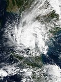
- 2019 – Tropical Storm Pabuk (pictured) made landfall in Southern Thailand, killing 10 people, with damages of about US$157 million. Pabuk was the earliest-forming storm in both the Northwest Pacific and North Indian Ocean basins on record.
January 5
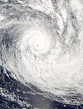
- 2005 - Cyclone Heta (pictured) reached its lowest pressure of 915 hPa (mbar). Heta caused $150 million in damage, mostly on American Samoa.
- 2013 - Tropical Storm Sonamu reached peak intensity north of Borneo. The name was retired thereafter due to its pronunciation as it sounded like tsunami.
- 2018 - Cyclone Ava struck eastern Madagascar, resulting in 51 deaths from its widespread floods.
Did you know…


- …that the Australian region have three distinct lists of names for tropical storms, each one of them being administered by agencies in Australia, Indonesia and Papua New Guinea, respectively?
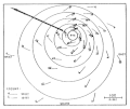
- …that the Joint Typhoon Warning Center considers that Typhoon Vera (pictured) of 1986 is actually two distinct systems, formed from two separated low-level circulations?
- …that Cyclone Freddy (track pictured) in 2023 was the longest-lasting tropical cyclone recorded?
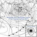
- …that the typhoons of 2024—Yinxing, Toraji, Usagi, and Man-yi (pictured)—made history as the first recorded instance since 1951 of four tropical cyclones coexisting in November?
General images -
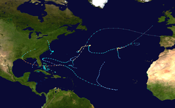
The 1992 Atlantic hurricane season was among the least active of any Atlantic hurricane season on record. It produced six named tropical cyclones. The season officially started on June 1, 1992, and ended on November 30. These dates, adopted by convention, historically delimit the period each year when most Atlantic tropical systems form. However, storm formation is possible at any time of the year, as was the case this season, when Subtropical Storm One formed on April 21. This timeline documents all the storm formations, strengthening, weakening, landfalls, extratropical transitions, as well as dissipations during the season.
During the year, three tropical depressions, one subtropical storm, two tropical storms, and four hurricanes formed. It produced seven storms, less than the average of ten usually formed throughout an Atlantic hurricane season, while four of the storms went on to become hurricanes. The first cyclone to form inside the official season was Tropical Depression One, which formed on June 25. Of the four hurricanes, Hurricane Andrew was the most intense, reaching category 5 status. In late June, Tropical Depression One caused severe flooding in southwestern Florida and Cuba; heavy rainfall was recorded in Pinar del Río, Matanzas, and Havana. When Andrew struck Florida and Louisiana in August, it became the second-costliest hurricane to hit the United States. Damages were estimated to be about $26.5 billion and 68 people were killed. Tropical Storm Danielle made landfall at the Delmarva Peninsula on the Virginian coast on September 25, causing minimal flooding. There was one recorded death recorded due to Danielle; a ship east of New Jersey was sunk due to rough seas. The season finished on October 30 when Hurricane Frances became an extratropical gale before dissipating. (Full article...)
Topics
Subcategories
Related WikiProjects
WikiProject Tropical cyclones is the central point of coordination for Wikipedia's coverage of tropical cyclones. Feel free to help!
WikiProject Weather is the main center point of coordination for Wikipedia's coverage of meteorology in general, and the parent project of WikiProject Tropical cyclones. Three other branches of WikiProject Weather in particular share significant overlaps with WikiProject Tropical cyclones:
- The Non-tropical storms task force coordinates most of Wikipedia's coverage on extratropical cyclones, which tropical cyclones often transition into near the end of their lifespan.
- The Floods task force takes on the scope of flooding events all over the world, with rainfall from tropical cyclones a significant factor in many of them.
- WikiProject Severe weather documents the effects of extreme weather such as tornadoes, which landfalling tropical cyclones can produce.
Things you can do
 |
Here are some tasks awaiting attention:
|
Wikimedia
The following Wikimedia Foundation sister projects provide more on this subject:
-
Commons
Free media repository -
Wikibooks
Free textbooks and manuals -
Wikidata
Free knowledge base -
Wikinews
Free-content news -
Wikiquote
Collection of quotations -
Wikisource
Free-content library -
Wikiversity
Free learning tools -
Wikivoyage
Free travel guide -
Wiktionary
Dictionary and thesaurus


