
Marathon County, Wisconsin
Marathon County, Wisconsin | |
|---|---|
 Marathon County Courthouse in Wausau | |
 Location within the U.S. state of Wisconsin | |
 Wisconsin's location within the U.S. | |
| Coordinates: 44°54′N 89°46′W / 44.9°N 89.76°W | |
| Country | |
| State | |
| Founded | 1850 |
| Named after | Marathon, Greece |
| Seat | Wausau |
| Largest city | Wausau |
| Area | |
• Total | 1,576 sq mi (4,080 km2) |
| • Land | 1,545 sq mi (4,000 km2) |
| • Water | 31 sq mi (80 km2) 2.0% |
| Population | |
• Total | 138,013 |
• Estimate (2024) | 139,091 |
| • Density | 89.3/sq mi (34.5/km2) |
| Time zone | UTC−6 (Central) |
| • Summer (DST) | UTC−5 (CDT) |
| Congressional district | 7th |
| Website | www |


Marathon County is a county located in the U.S. state of Wisconsin. As of the 2020 census, the population was 138,013.[1] Its county seat is Wausau.[2] It was founded in 1850,[2] created from a portion of Portage County. At that time the county stretched to the northern border with the Upper Peninsula of Michigan. It is named after the battlefield at Marathon, Greece.[3]
Marathon County comprises the Wausau, WI Metropolitan Statistical Area and is included in the Wausau–Stevens Point–Wisconsin Rapids, WI Combined Statistical Area.
Geography
[edit]According to the U.S. Census Bureau, the county has a total area of 1,576 square miles (4,080 km2), of which 1,545 square miles (4,000 km2) is land and 31 square miles (80 km2) (2.0%) is water.[4] It is the largest county in Wisconsin by land area and fourth-largest by total area.

The Marathon County Park Commission has posted a geographical marker[5] that identifies the spot (45°N, 90°W) of the exact center of the northern half of the Western Hemisphere, meaning that it is a quarter of the way around the world from the Prime Meridian and halfway from the Equator to the North Pole.
Major highways
[edit] Interstate 39
 US Highway 51
 Wisconsin Highway 13
 Wisconsin Highway 29
 Wisconsin Highway 34
 Wisconsin Highway 49
 Wisconsin Highway 52
 Wisconsin Highway 97
 Wisconsin Highway 98
 Wisconsin Highway 107
 Wisconsin Highway 153
Railroads
[edit]Buses
[edit]Airports
[edit]- KAUW - Wausau Downtown Airport
- KCWA - Central Wisconsin Airport
Adjacent counties
[edit]- Lincoln County - north
- Langlade County - northeast
- Shawano County - east
- Waupaca County - southeast
- Portage County - south
- Wood County - south
- Clark County - west
- Taylor County - northwest
Natural wildlife refuges
[edit]Demographics
[edit]| Census | Pop. | Note | %± |
|---|---|---|---|
| 1850 | 508 | — | |
| 1860 | 2,892 | 469.3% | |
| 1870 | 5,885 | 103.5% | |
| 1880 | 17,121 | 190.9% | |
| 1890 | 30,369 | 77.4% | |
| 1900 | 43,256 | 42.4% | |
| 1910 | 55,054 | 27.3% | |
| 1920 | 65,259 | 18.5% | |
| 1930 | 70,629 | 8.2% | |
| 1940 | 75,915 | 7.5% | |
| 1950 | 80,337 | 5.8% | |
| 1960 | 88,874 | 10.6% | |
| 1970 | 97,457 | 9.7% | |
| 1980 | 111,270 | 14.2% | |
| 1990 | 115,400 | 3.7% | |
| 2000 | 125,834 | 9.0% | |
| 2010 | 134,063 | 6.5% | |
| 2020 | 138,013 | 2.9% | |
| 2024 (est.) | 139,091 | [6] | 0.8% |
| U.S. Decennial Census[7] 1790–1960[8] 1900–1990[9] 1990–2000[10] 2010 [11] 2020[1] | |||
2020 census
[edit]As of the census of 2020,[1] the population was 138,013. The population density was 89.3 people per square mile (34.5 people/km2). There were 59,828 housing units at an average density of 38.7 units per square mile (14.9 units/km2). The racial makeup of the county was 86.9% White, 6.2% Asian, 0.9% Black or African American, 0.5% Native American, 1.3% from other races, and 4.3% from two or more races. Ethnically, the population was 3.2% Hispanic or Latino of any race.

2000 census
[edit]As of the census[12] of 2000, there were 125,834 people, 47,702 households, and 33,868 families residing in the county. The population density was 81 people per square mile (31 people/km2). There were 50,360 housing units at an average density of 33 units per square mile (13 units/km2). The racial makeup of the county was 93.84% White, 0.28% Black or African American, 0.35% Native American, 4.54% Asian, 0.02% Pacific Islander, 0.26% from other races, and 0.72% from two or more races. 0.78% of the population were Hispanic or Latino of any race. 52.6% were of German and 13.6% Polish ancestry. 92.9% spoke English, 3.4% Hmong, 1.1% German and 1.1% Spanish as their first language.
There were 47,702 households, out of which 34.00% had children under the age of 18 living with them, 59.90% were married couples living together, 7.40% had a female householder with no husband present, and 29.00% were non-families. 23.60% of all households were made up of individuals, and 9.50% had someone living alone who was 65 years of age or older. The average household size was 2.60 and the average family size was 3.11.
In the county, the population was spread out, with 26.80% under the age of 18, 8.20% from 18 to 24, 29.50% from 25 to 44, 22.50% from 45 to 64, and 13.00% who were 65 years of age or older. The median age was 36 years. For every 100 females, there were 99.50 males. For every 100 females aged 18 and over, there were 97.40 males.
Libraries
[edit]The Marathon County Public Library (MCPL) has its headquarters in downtown Wausau, Wisconsin. Eight branch libraries have been established in the cities of Athens, Edgar, Hatley, Marathon City, Mosinee, Rothschild, Spencer, and Stratford.
Recreation
[edit]County parks
[edit]- Amco County Park
- Big Eau Pleine County Park
- Big Rapids County Park
- Bluegill Bay County Park
- Cherokee County Park
- Courthouse Square
- D.C. Everest County Park
- Dells of the Eau Claire County Park
- Duane L. Corbin Shooting Range Park
- Library Park
- Marathon Park
- Mission Lake County Park
- Mountain-Bay State Park Trail
- Reitbrock Geographical Marker
- Rib Falls County Park
- Sunny Vale County Park
Snowmobile trails
[edit]There are over 884 miles of groomed snowmobile trails in Marathon County maintained by 29 area snowmobile clubs. [13]
Communities
[edit]
Cities
[edit]- Abbotsford (mostly in Clark County)
- Colby (mostly in Clark County)
- Marshfield (mostly in Wood County)
- Mosinee
- Schofield
- Wausau (county seat)
Villages
[edit]- Athens
- Birnamwood (mostly in Shawano County)
- Dorchester (mostly in Clark County)
- Edgar
- Elderon
- Fenwood
- Hatley
- Kronenwetter
- Maine
- Marathon City
- Rib Mountain
- Rothschild
- Spencer
- Stratford
- Unity (partly in Clark County)
- Weston
Towns
[edit]- Bergen
- Berlin
- Bern
- Bevent
- Brighton
- Cassel
- Cleveland
- Day
- Easton
- Eau Pleine
- Elderon
- Emmet
- Frankfort
- Franzen
- Green Valley
- Guenther
- Halsey
- Hamburg
- Harrison
- Hewitt
- Holton
- Hull
- Johnson
- Knowlton
- Marathon
- McMillan
- Mosinee
- Norrie
- Plover
- Reid
- Rib Falls
- Rietbrock
- Ringle
- Spencer
- Stettin
- Texas
- Wausau
- Weston
- Wien
Census-designated places
[edit]Unincorporated communities
[edit]- Ashley
- Bradley
- Cherokee
- Corinth
- Dancy
- Emmerich
- Evergreen
- Gad (partial)
- Galloway
- Glandon
- Granite Heights
- Halder
- Hamburg
- Hogarty
- Holt
- Johnson
- Kalinke
- Little Chicago
- Little Eau Claire
- Little Rose
- Mann
- March Rapids
- McMillan
- Milan
- Moon
- Mount View
- Naugart
- Norrie
- Nutterville
- Pike Lake
- Poniatowski
- Rangeline
- Rib Falls
- Ringle
- Rocky Corners
- Rozellville
- Schnappsville
- Snell
- Shantytown
- Sunset
- Swan
- Taegesville
- Weber
- Wien
- Wuertsburg
Ghost towns/neighborhoods
[edit]Government and politics
[edit]| Year | Republican | Democratic | Third party(ies) | |||
|---|---|---|---|---|---|---|
| No. | % | No. | % | No. | % | |
| 1892 | 1,959 | 33.04% | 3,791 | 63.94% | 179 | 3.02% |
| 1896 | 3,958 | 49.62% | 3,829 | 48.00% | 190 | 2.38% |
| 1900 | 4,717 | 54.32% | 3,768 | 43.40% | 198 | 2.28% |
| 1904 | 6,144 | 63.24% | 3,225 | 33.19% | 347 | 3.57% |
| 1908 | 5,258 | 50.62% | 4,722 | 45.46% | 408 | 3.93% |
| 1912 | 3,033 | 33.20% | 4,043 | 44.26% | 2,059 | 22.54% |
| 1916 | 5,838 | 57.03% | 3,677 | 35.92% | 722 | 7.05% |
| 1920 | 11,356 | 65.53% | 2,133 | 12.31% | 3,840 | 22.16% |
| 1924 | 5,577 | 29.22% | 1,109 | 5.81% | 12,402 | 64.97% |
| 1928 | 10,127 | 48.02% | 10,675 | 50.61% | 289 | 1.37% |
| 1932 | 6,210 | 25.24% | 17,744 | 72.13% | 647 | 2.63% |
| 1936 | 7,328 | 27.06% | 17,898 | 66.10% | 1,850 | 6.83% |
| 1940 | 15,264 | 51.80% | 13,724 | 46.57% | 481 | 1.63% |
| 1944 | 15,782 | 53.54% | 13,192 | 44.75% | 503 | 1.71% |
| 1948 | 11,494 | 40.93% | 15,898 | 56.62% | 687 | 2.45% |
| 1952 | 20,702 | 58.52% | 14,541 | 41.11% | 130 | 0.37% |
| 1956 | 22,586 | 59.36% | 15,301 | 40.21% | 164 | 0.43% |
| 1960 | 21,880 | 54.67% | 18,145 | 45.33% | 0 | 0.00% |
| 1964 | 12,766 | 34.11% | 24,603 | 65.74% | 57 | 0.15% |
| 1968 | 16,907 | 44.40% | 18,063 | 47.43% | 3,111 | 8.17% |
| 1972 | 21,454 | 51.28% | 18,500 | 44.22% | 1,885 | 4.51% |
| 1976 | 21,898 | 45.62% | 24,934 | 51.94% | 1,169 | 2.44% |
| 1980 | 25,868 | 48.34% | 23,281 | 43.50% | 4,365 | 8.16% |
| 1984 | 27,080 | 55.64% | 20,128 | 41.36% | 1,462 | 3.00% |
| 1988 | 24,482 | 49.44% | 24,658 | 49.79% | 381 | 0.77% |
| 1992 | 20,948 | 36.51% | 21,482 | 37.44% | 14,948 | 26.05% |
| 1996 | 19,874 | 38.63% | 24,012 | 46.67% | 7,563 | 14.70% |
| 2000 | 28,883 | 49.48% | 26,546 | 45.48% | 2,945 | 5.05% |
| 2004 | 36,394 | 53.47% | 30,899 | 45.40% | 766 | 1.13% |
| 2008 | 30,345 | 44.66% | 36,367 | 53.53% | 1,228 | 1.81% |
| 2012 | 36,617 | 52.41% | 32,363 | 46.32% | 882 | 1.26% |
| 2016 | 39,014 | 56.12% | 26,481 | 38.09% | 4,023 | 5.79% |
| 2020 | 44,624 | 58.14% | 30,808 | 40.14% | 1,319 | 1.72% |
| 2024 | 46,213 | 58.63% | 31,529 | 40.00% | 1,084 | 1.38% |
Government
[edit]In the United States Senate, Marathon County is represented by Republican Ron Johnson and Democrat Tammy Baldwin. In the United States House of Representatives, the county lies within Wisconsin's 7th congressional district, represented by Republican Tom Tiffany. At the state level, Marathon County lies within the Wisconsin Senate's 23rd and 29th districts (mostly the latter), represented by Republicans Jesse James and Cory Tomczyk, respectively, and the Wisconsin State Assembly's 69th, 85th, 86th, and 87th districts (mostly the latter three), represented by Republicans Karen Hurd, Patrick Snyder, John Spiros, and Brent Jacobson, respectively. Judicially, the county lies within the Wisconsin Court of Appeals's third district and the ninth Wisconsin circuit court (of which it is the seat). At the local level, Marathon County has several elected officials and is governed by a 38-member county board, elected by district.
Politics
[edit]At founding, Marathon was reliably Democratic, attributed to its large population of German Catholic immigrants, who had many grievances against the Republican Party.[15] In 1896, the Democratic Party's adoption of the populist movement infuriated the local anti-free silver Germans, and Marathon broke for the Republican Party for the first time since formation.[16] Deeply progressive, the county saw the Democratic Party's perceived abandonment of progressive values as an offense, and like the state became a Republican stronghold for the next four election cycles.[17] Marathon's semi-urban but largely rural and heavily German Catholic population, which reflected the demographics of the state, led to it eventually becoming one of the most reliable bellwether counties in the state, voting for the candidate that won the state in every election between 1892 and 1996 (with two exceptions: 1928, when the losing candidate was a Catholic, and 1940, when many German Americans turned sharply away from Franklin D. Roosevelt, who was seen as Anglophilic). Starting in 2000, Marathon County began following the trend of many other rural counties, breaking for George W. Bush even as Wisconsin remained a safely blue state and continuing to shift rightward (with the exception of Barack Obama's 2008 landslide). Since 2008, Republicans have gained ground in the county in every election cycle even as the state has flip-flopped between Republicans and Democrats. Marathon County's Republican swing has continued locally as well - it has not voted for a Democrat at the state level since 2006, and Republicans won the mayoralty of Wausau in 2024.[18]
Education
[edit]School districts include:[19]
- Abbotsford School District
- Antigo School District
- Athens School District
- Auburndale School District
- Colby School District
- D.C. Everest Area School District
- Edgar School District
- Marathon City School District
- Marshfield School District
- Medford Area School District
- Merrill Area School District
- Mosinee School District
- Rosholt School District
- Spencer School District
- Stratford School District
- Wausau School District
- Wittenberg-Birnamwood School District
See also
[edit]References
[edit]- ^ a b c d "2020 Decennial Census: Marathon County, Wisconsin". data.census.gov. U.S. Census Bureau. Retrieved July 4, 2022.
- ^ a b "Find a County". National Association of Counties. Retrieved June 7, 2011.
- ^ "Here's How Iron Got Its Name". The Rhinelander Daily News. June 16, 1932. p. 2. Retrieved August 24, 2014 – via Newspapers.com.

- ^ "2010 Census Gazetteer Files". United States Census Bureau. August 22, 2012. Retrieved August 6, 2015.
- ^ "Archived copy". Archived from the original on October 12, 2016. Retrieved December 14, 2021.
{{cite web}}: CS1 maint: archived copy as title (link) - ^ "Population and Housing Unit Estimates Tables". United States Census Bureau. Retrieved July 24, 2025.
- ^ "U.S. Decennial Census". United States Census Bureau. Retrieved August 6, 2015.
- ^ "Historical Census Browser". University of Virginia Library. Retrieved August 6, 2015.
- ^ Forstall, Richard L., ed. (March 27, 1995). "Population of Counties by Decennial Census: 1900 to 1990". United States Census Bureau. Retrieved August 6, 2015.
- ^ "Census 2000 PHC-T-4. Ranking Tables for Counties: 1990 and 2000" (PDF). United States Census Bureau. April 2, 2001. Archived (PDF) from the original on October 9, 2022. Retrieved August 6, 2015.
- ^ "State & County QuickFacts". United States Census Bureau. Archived from the original on June 6, 2011. Retrieved January 22, 2014.
- ^ "U.S. Census website". United States Census Bureau. Retrieved May 14, 2011.
- ^ "Marathon County Parks, Recreation, Forestry Department". Marathon County, Wisconsin. Archived from the original on September 4, 2019. Retrieved March 12, 2015.
- ^ Leip, David. "Dave Leip's Atlas of U.S. Presidential Elections". uselectionatlas.org. Retrieved November 9, 2020.
- ^ Phillips, Kevin P.; The Emerging Republican Majority, pp. 381-382, 414 ISBN 978-0-691-16324-6
- ^ Phillips; The Emerging Republican Majority, p. 384
- ^ Sundquist, James; Politics and Policy: The Eisenhower, Kennedy, and Johnson Years, p. 526 ISBN 0815719094
- ^ Mentzer, Rob (April 3, 2024). "Wausau Mayor Katie Rosenberg loses reelection bid". WPR. Retrieved November 18, 2025.
- ^ "2020 CENSUS - SCHOOL DISTRICT REFERENCE MAP: Marathon County, WI" (PDF). U.S. Census Bureau. Retrieved October 3, 2024. - Text list
External links
[edit]- Marathon County Archived February 27, 2018, at the Wayback Machine
- Marathon County map from the Wisconsin Department of Transportation
- Plat maps: ca. 1881 1901 1905-1917 ca. 1912 ca. 1920 1930
- Libraries and Schools in Marathon and Lincoln Counties - Digital collection of historic images and texts on schools and libraries in Marathon and Lincoln Counties
Places adjacent to Marathon County, Wisconsin | ||||||||||||||||
|---|---|---|---|---|---|---|---|---|---|---|---|---|---|---|---|---|
| ||||||||||||||||
| Surrounding communities |
|  | ||
|---|---|---|---|---|
| Counties | ||||
Municipalities and communities of Marathon County, Wisconsin, United States | ||
|---|---|---|
| Cities | 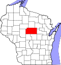 | |
| Villages | ||
| Towns |
| |
| CDPs | ||
| Unincorporated communities |
| |
| Ghost towns/ neighborhoods | ||
| Indian reservation | ||
| Footnotes | ‡This populated place also has portions in an adjacent county or counties | |
| International | |
|---|---|
| National | |
| Other | |