
Kremitzaue
Kremitzaue | |
|---|---|
Location of Kremitzaue
within Elbe-Elster district 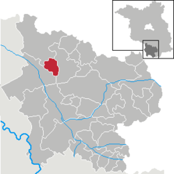 | |
 Location of Kremitzaue | |
 Kremitzaue  Kremitzaue | |
| Coordinates: 51°36′00″N 13°40′00″E / 51.60000°N 13.66667°E | |
| Country | Germany |
| State | Brandenburg |
| District | Elbe-Elster |
| Municipal assoc. | Schlieben |
| Subdivisions | 3 Ortsteile |
| Government | |
| • Mayor (2024–29) | Reinhard Claus[1] |
| Area | |
• Total | 23.41 km2 (9.04 sq mi) |
| Elevation | 90 m (300 ft) |
| Population (2023-12-31)[2] | |
• Total | 786 |
| • Density | 33.6/km2 (87.0/sq mi) |
| Time zone | UTC+01:00 (CET) |
| • Summer (DST) | UTC+02:00 (CEST) |
| Postal codes | 04936 |
| Dialling codes | 035361 |
| Vehicle registration | EE, FI, LIB |
Kremitzaue is a municipality in the Elbe-Elster district, in Brandenburg, Germany.
History
[edit]From 1815 to 1944, the constituent localities of Kremitzaue were part of the Prussian Province of Saxony. From 1944 to 1945, they were part of the Province of Halle-Merseburg. From 1952 to 1990, they were part of the Bezirk Cottbus of East Germany. On 31 December 2001, the municipality of Kremitzaue was formed by merging the municipalities of Kolochau, Malitschkendorf and Polzen.
Demography
[edit]
|
|
|
|
References
[edit]- ^ Landkreis Elbe-Elster Wahl der Bürgermeisterin / des Bürgermeisters. Retrieved 27 June 2024.
- ^ "Alle politisch selbständigen Gemeinden mit ausgewählten Merkmalen am 31.12.2023" (in German). Federal Statistical Office of Germany. 28 October 2024. Retrieved 16 November 2024.
- ^ Detailed data sources are to be found in the Wikimedia Commons.Population Projection Brandenburg at Wikimedia Commons
Towns and municipalities in Elbe-Elster | ||
|---|---|---|
|  | |
This Brandenburg location article is a stub. You can help Wikipedia by expanding it. |