
Karlstadt am Main
Karlstadt am Main | |
|---|---|
 Old town of Karlstadt with the new building area at the Saupurzel in the background | |
 Coat of arms | |
Location of Karlstadt am Main within Main-Spessart district  | |
 Karlstadt am Main  Karlstadt am Main | |
| Coordinates: 49°57′37″N 9°46′20″E / 49.96028°N 9.77222°E | |
| Country | Germany |
| State | Bavaria |
| Admin. region | Unterfranken |
| District | Main-Spessart |
| Subdivisions | 10 Ortsteile |
| Government | |
| • Mayor (2020–26) | Michael Hombach[1] (CSU) |
| Area | |
| • Total | 98.11 km2 (37.88 sq mi) |
| Elevation | 163 m (535 ft) |
| Population (2024-12-31)[2] | |
| • Total | 14,739 |
| • Density | 150/km2 (390/sq mi) |
| Time zone | UTC+01:00 (CET) |
| • Summer (DST) | UTC+02:00 (CEST) |
| Postal codes | 97753 |
| Dialling codes | 09353, 09359 (Rohrbach) |
| Vehicle registration | MSP |
| Website | www.karlstadt.de |
Karlstadt is a town in Main-Spessart in the Regierungsbezirk of Lower Franconia (Unterfranken) in Bavaria, Germany. It is the administrative centre of Main-Spessart (Kreisstadt), and has a population of around 15,000.
Geography
[change | change source]Karlstadt is on the River Main in Main-Spessart, about 25 km north of the city of Würzburg. It belongs to the Main-Franconian wine-growing region. The town itself is on the right edge of the river, but the municipal territory extends to the left edge.
Since the combinations in 1978, Karlstadt's Stadtteile have been Gambach, Heßlar, Karlburg, Karlstadt, Laudenbach, Mühlbach, Rohrbach, Stadelhofen, Stetten, and Wiesenfeld.
Notable people
[change | change source]

- Johannes Schöner (b. 1477, d. 1547 in Nuremberg), mathematician, geographer, cartographer, astronomer, and astrologist
- Andreas Bodenstein (b. about 1482, d. 1541 in Basel), also named after his birthplace Karlstadt, or in Latinized form Carolstadius, reformer
- Johann Draconites (b. about 1494, d. 1566 in Wittenberg), theologian, humanistic philosopher, and reformer
- Michael Beuther (b. 1522, d. 1587 in Strasbourg), historian, poet, jurist, and official
- Johann Rudolph Glauber (b. 1604 in Karlstadt; d. 1670 in Amsterdam), apothecary and chemist
- Franz Sperr (b. 1878, d. 23 January 1945 executed in Berlin-Plötzensee), jurist and member of the Widerstand in the Third Reich
- Bernhard Fech (b. 1887, d. 1915 near Soldau in Masuria), painter
- Hermann Sendelbach (b. 1894 in Wiesenfeld-Erlenbach, d. 1971), writer, poet
- Ruth Westheimer (b. Karola Ruth Siegel and known as "Dr. Ruth," 4 June 1928 in Wiesenfeld), sex therapist, talk show host, author, professor, Holocaust survivor, and former Haganah sniper; later, U.S. citizen.
- Detlef Wagenthaler (b. 1948 in Aschaffenburg, d. 2007 in Karlstadt), carnevalist
- Roland Büchner (b. 1954), Regensburg cathedral choirmaster, conductor, leader of the Regensburger Domspatzen
Gallery
[change | change source]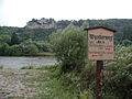 Karlsburg, Karlstadt, on the west bank of the Main
 Main gate with flood gauge, Karlstadt
 Main gate tower and main gate, Karlstadt
 Bond of the town of Karlstadt am Main, issued 1 September 1888


References
[change | change source]- ↑ Liste der ersten Bürgermeister/Oberbürgermeister in kreisangehörigen Gemeinden, Bayerisches Landesamt für Statistik, 15 July 2021.
- ↑ "Gemeinden, Kreise und Regierungsbezirke in Bayern, Einwohnerzahlen am 31. Dezember 2024; Basis Zensus 2022" [Municipalities, counties, and administrative districts in Bavaria; Based on the 2022 Census] (CSV) (in German). Bayerisches Landesamt für Statistik.
Other websites
[change | change source]Wikimedia Commons has media related to Karlstadt.
- Town’s official webpage (in German)
- Karlstadt am Main. In: Meyers Konversations-Lexikon. 4. Auflage. Band 9, Verlag des Bibliographischen Instituts, Leipzig/Wien 1885–1892, S. 546.

| International | |
|---|---|
| National | |
| Geographic | |
| Other | |