Fonds-des-Nègres
Appearance
Fonds-des-Nègres
Fondènèg | |
|---|---|
| Coordinates: 18°21′0″N 73°14′0″W / 18.35000°N 73.23333°W | |
| Country | Haiti |
| Department | Nippes |
| Arrondissement | Miragoâne |
| Area | |
• Total | 92.23 km2 (35.61 sq mi) |
| Elevation | 396 m (1,299 ft) |
| Population (2015)[1] | |
• Total | 33,413 |
| • Density | 362.3/km2 (938.3/sq mi) |
| Time zone | UTC−05:00 (EST) |
| • Summer (DST) | UTC−04:00 (EDT) |
| Postal code | HT 7413 |
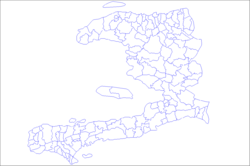
Fonds-des-Nègres (French pronunciation: [fɔ̃ de nɛɡʁ]; Haitian Creole: Fondènèg) is a commune in the Miragoâne Arrondissement, in the Nippes department of Haiti.
Climate
[edit]| Climate data for Fonds-des-Nègres | |||||||||||||
|---|---|---|---|---|---|---|---|---|---|---|---|---|---|
| Month | Jan | Feb | Mar | Apr | May | Jun | Jul | Aug | Sep | Oct | Nov | Dec | Year |
| Mean daily maximum °C (°F) | 28.8 (83.8) |
28.7 (83.7) |
28.9 (84.0) |
29.0 (84.2) |
28.9 (84.0) |
29.9 (85.8) |
30.4 (86.7) |
30.5 (86.9) |
30.5 (86.9) |
29.6 (85.3) |
28.8 (83.8) |
28.2 (82.8) |
29.4 (84.8) |
| Mean daily minimum °C (°F) | 16.3 (61.3) |
16.7 (62.1) |
17.8 (64.0) |
19.1 (66.4) |
19.9 (67.8) |
20.6 (69.1) |
20.5 (68.9) |
20.6 (69.1) |
20.5 (68.9) |
20.1 (68.2) |
18.9 (66.0) |
17.5 (63.5) |
19.0 (66.3) |
| Average precipitation mm (inches) | 46 (1.8) |
45 (1.8) |
61 (2.4) |
126 (5.0) |
192 (7.6) |
129 (5.1) |
119 (4.7) |
185 (7.3) |
155 (6.1) |
216 (8.5) |
97 (3.8) |
33 (1.3) |
1,404 (55.4) |
| Source: CLIMATE-DATA.ORG[2] | |||||||||||||
References
[edit]- ^ "POPULATION TOTALE, POPULATION DE 18 ANS ET PLUS - MÉNAGES ET DENSITÉS ESTIMÉS EN 2015" (PDF).
- ^ "Climate in Fonds-des-Nègres, Haiti". en.climate-data.org.


