
File:MelbLGA-MorningtonPeninsula.gif
No higher resolution available.
MelbLGA-MorningtonPeninsula.gif (250 × 188 pixels, file size: 5 KB, MIME type: image/gif, 0.1 s)
This is a file from the Wikimedia Commons. Information from its description page there is shown below.
Commons is a freely licensed media file repository. You can help.
Commons is a freely licensed media file repository. You can help.
Summary
| Description | |
| Date | |
| Source | Own work |
| Author | John Shadbolt |
| Other versions | w:user:JohnnoShadbolt/Melbourne maps |
Licensing
| I, the copyright holder of this work, release this work into the public domain. This applies worldwide. In some countries this may not be legally possible; if so: I grant anyone the right to use this work for any purpose, without any conditions, unless such conditions are required by law. |
File history
Click on a date/time to view the file as it appeared at that time.
| Date/Time | Thumbnail | Dimensions | User | Comment | |
|---|---|---|---|---|---|
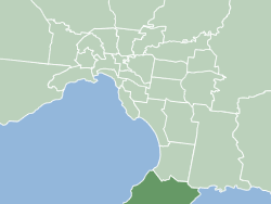
| current | 05:21, 20 November 2006 | | 250 × 188 (5 KB) | JohnnoShadbolt | {{Information |Description=Map of Melbourne's Local Government Areas, highlighting City of Mornington Peninsula |Source=Own work. |Date=2006-11-20 |Author=[http://en.wikipedia.org/wiki/User:JohnnoShadbolt John S |
File usage
The following 47 pages use this file:
- Arthurs Seat, Victoria
- Balnarring
- Balnarring Beach
- Baxter, Victoria
- Bittern, Victoria
- Blairgowrie, Victoria
- Boneo
- Cape Schanck
- Capel Sound
- Crib Point
- Dromana
- Fingal, Victoria
- Flinders, Victoria
- HMAS Cerberus (naval base)
- Hastings, Victoria
- Local government areas of Victoria
- Main Ridge, Victoria
- McCrae, Victoria
- Merricks
- Merricks Beach
- Merricks North
- Moorooduc
- Mornington, Victoria
- Mount Eliza, Victoria
- Mount Martha, Victoria
- Pearcedale
- Point Leo
- Portsea, Victoria
- Red Hill, Victoria
- Red Hill South
- Rosebud, Victoria
- Rye, Victoria
- Safety Beach
- Shire of Mornington Peninsula
- Shoreham, Victoria
- Somers, Victoria
- Somerville, Victoria
- Sorrento, Victoria
- St Andrews Beach
- Tootgarook
- Tuerong
- Tyabb
- User:JohnnoShadbolt/Maps
- User:PK2/Local government areas of Victoria
- User:ThylacineHunter/LGA
- Template:Shire of Mornington Peninsula suburbs
- Category:Shire of Mornington Peninsula
Global file usage
The following other wikis use this file:
- Usage on vi.wikipedia.org
- Usage on zh.wikipedia.org