
List of U.S. Routes in California
| U.S. Routes in California | |
|---|---|
.svg?lang=en) .svg?lang=en) .svg?lang=en) Highway shields for US 6, US 95, and US 101 | |
 U.S. Routes highlighted in red | |
| System information | |
| Maintained by Caltrans | |
| Length | 1,721.644 mi (2,770.717 km) |
| Formed | November 11, 1926[1] |
| Highway names | |
| US Highways | U.S. Route XX (US XX) |
| Special Routes: | U.S. Route XX Alternate (US XX Alt.); U.S. Route XX Business (US XX Bus.); |
| System links | |
This is a list of U.S. Routes in the U.S. state of California. It includes routes defined by the California State Legislature but never built, as well as routes entirely relinquished to local governments. It also includes the routes that were decommissioned during the 1964 state highway renumbering.
Each U.S. Route in California is maintained by the California Department of Transportation (Caltrans) and is assigned a Route (officially State Highway Route[2][3]) number in the Streets and Highways Code (Sections 300-635). Under the code, the state assigns a unique Route X to each highway and does not differentiate between state, US, or Interstate highways.
California still uses a version of the 1961 U.S. Route shield, featuring a simplified cutout shield containing only the outer border, "U S," and the route marker. All other U.S. states adopted the 1971 version of the marker, consisting of a white shield outline on a black square background.
Mainline routes
[edit]- Interstate Highways and state highways that traverse California are also defined in the California Streets and Highways code as state routes. This list does not include these state routes as they are listed separately.
- The years listed reflect when the route was affected by legislative action, this is not necessarily the same year as the actual construction or signing changes to the route.
- Concurrencies are not explicitly codified in the Streets and Highways Code; such highway segments are listed on only one of the corresponding legislative route numbers. For example, the I-10/US 95 concurrency between Blythe and the Arizona state line is only listed under Route 10 in the highway code while the definition of Route 95 omits the fact that it does connect to Arizona. When a highway is broken into such segments, the total length recorded by Caltrans only reflects those non-contiguous segments and does not include those overlaps that would be required to make the route continuous. Furthermore, Caltrans may not sign all concurrencies, and instead may only post the highway shields for the route with the contiguous segment in the code.
- Some highways are not contiguous as the state has relinquished control of small sections to local governments. The stated length of the highway may or may not reflect the portions under local control.
| Number | Length (mi)[4][a] | Length (km) | Southern or western terminus | Northern or eastern terminus | Formed | Removed | Notes | |
|---|---|---|---|---|---|---|---|---|
| 40.505 | 65.186 | US 395 in Bishop | US 6 at the Nevada state line | 1937 | current | Until 1964 western terminus was in Long Beach | ||
| — | — | US 101 in San Francisco | US 40 at the Nevada state line | 1926 | 1964 | Replaced by I-80 | ||
| 87.3[b][c] | 140.5 | US 101 in San Jose | French Camp Road in French Camp | 1926 | 1931 | Renumbered as US 50 | ||
| 108.624 | 174.813 | I-80 in West Sacramento | US 50 at the Nevada state line | 1926 | current | Until 1964 western terminus was in San Francisco | ||
| 255[b][c] | 410 | I-5 and former US 99 in Los Angeles | US 60 / US 70 at the Arizona state line | 1926 | 1972 | Replaced by I-10; ran concurrently with US 70 | ||
| 315[b][c] | 507 | SR 1 and former US 101 Alt. in Santa Monica | US 66 at the Arizona state line | 1926 | 1969 | Replaced by I-40 and other routes | ||
| 255[b][c] | 410 | I-5 and former US 99 in Los Angeles | US 60 / US 70 at the Arizona state line | 1926 | 1964 | Replaced by I-10; ran concurrently with US 60 | ||
| 176.53[b][c] | 284.10 | I-5 and former US 101 in San Diego | US 80 at the Arizona state line | 1926 | 1964 | Replaced by I-8 | ||
| — | — | SR 1 and former US 101 Alt. in Long Beach | US 91 / US 466 Nevada state line | 1926 | 1971 | Replaced by I-15 and SR 91 | ||
| 116.721[d] | 187.844 | I-10 / US 95 at the Arizona state line | US 95 at the Nevada state line | 1930 | current | |||
| 54.364 | 87.490 | I-5 in Weed | US 97 at the Oregon state line | 1935 | current | |||
| 754[b][c] | 1,213 | Fed. 5 near Calexico | US 99 at the Oregon state line | 1926 | 1964 | Replaced by I-5; completely decommissioned in 1972 | ||
| 141[b][c] | 227 | SR 99 and former US 99 in Wheeler Ridge | SR 99 and former US 99 in Sacramento | 1929 | 1933 | Most of former US 99E is now part of SR 99 | ||
| — | — | SR 99 and former US 99 in Wheeler Ridge | SR 99 and former US 99 in Sacramento | 1929 | 1964 | Replaced by majority of I-5 | ||
| 808.111[b] | 1,300.529 | I-5 / I-10 / SR 60 in Los Angeles | US 101 at the Oregon state line | 1926 | current | Segment across the Golden Gate Bridge is not officially recognized as part of the state highway system; until 1964 southern terminus was in San Diego | ||
| — | — | I-880 and US 101 | I-580 and US 101 | 1929 | 1940 | Reverted to US 101 after US 101E was decommissioned | ||
| — | — | US 101 | US 101 | 1929 | 1940 | Renumbered into SR 17 | ||
| 36.41 | 58.60 | US 101 near Crescent City | US 199 at the Oregon state line | 1926 | current | |||
| 304[b][c] | 489 | US 101 in Arcata | US 395 in Alturas | 1934 | 1964 | Replaced by the majority of SR 299 | ||
| 556.909[b][c] | 896.258 | I-15 near Hesperia US 395 at the Nevada state line |
US 395 at the Nevada state line US 395 at the Oregon state line |
1979 | current | Split into two segments, as the highway clips into Nevada to serve Carson City and Reno; until 1969 southern terminus was in San Diego | ||
| 137[b][c] | 220 | US 101 in Ventura | SR 99 and former US 99 in Bakersfield | 1934 | 1964 | Replaced by SR 33 and SR 119 | ||
| 526[b][c] | 847 | SR 1 in Morro Bay | US 91 / US 466 at the Nevada state line | 1935 | 1965 | Replaced by SR 58 and I-15; ran concurrently with former US 91 | ||
| ||||||||
-
 Road sign on US 6 showing that it is 3205 miles to its eastern end in Provincetown, Massachusetts
 -
 US 50 westbound as it winds down Echo Summit towards the west
 -
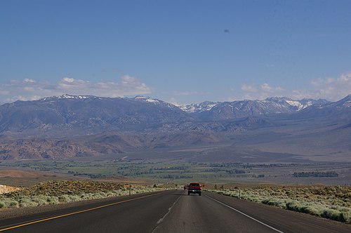
 US 95 southbound at the California-Nevada state line
 -
 US 97 sign on I-5 in the City of Weed
 -
 US 101 northbound approaching Gaviota Tunnel through the Santa Ynez Mountains
 -
 US 199 southbound at the California-Oregon state line
 -


Special routes
[edit]Business routes in California are assigned by the California Department of Transportation (Caltrans), but are not maintained by Caltrans unless they overlay other routes of the state highway system. Local authorities may request route assignment from the Caltrans Transportation System Information Program, and all requests require approval of the executive committee of the American Association of State Highway and Transportation Officials (AASHTO).[5]
| Number | Length (mi) | Length (km) | Southern or western terminus | Northern or eastern terminus | Formed | Removed | Notes | |
|---|---|---|---|---|---|---|---|---|
| — | — | Oakland | Berkeley | — | — | |||
| — | — | American Canyon | Cordelia | — | — | |||
| — | — | — | — | — | — | Served West Sacramento | ||
| — | — | — | — | — | — | Served North Sacramento | ||
| — | — | Davis, California | California-Nevada state line | — | — | |||
| — | — | — | — | — | — | Served Oakland | ||
| — | — | — | — | — | — | Served Sacramento | ||
| — | — | Pollock Pines | South Lake Tahoe, California | — | — | Unofficial route that is activated and deactivated on multiple occasions when the main route of US 50 is closed due to flooding in the American River canyon | ||
| — | — | — | — | — | — | Served Riverside | ||
| — | — | — | — | — | — | Served Banning | ||
| — | — | Los Angeles | Pasadena | — | — | |||
| — | — | — | — | — | — | Served San Bernardino | ||
| — | — | — | — | — | — | Served San Bernardino | ||
| — | — | — | — | — | — | Served Pomona | ||
| — | — | — | — | — | — | Served Banning | ||
| — | — | — | — | — | — | Served San Diego | ||
| — | — | Winterhaven | Arizona-California state line | — | — | |||
| — | — | Corona | Riverside | — | — | |||
| — | — | Colton | San Bernardino | — | — | |||
| — | — | — | — | — | — | Served Victorville | ||
| — | — | — | — | — | — | Served Banning | ||
| — | — | — | — | — | — | Served Pomona | ||
| — | — | Elysian Park | Sylmar | — | — | |||
| — | — | — | — | — | — | Served Fresno | ||
| — | — | — | — | — | — | Served Merced | ||
| — | — | — | — | — | — | Served Atwater | ||
| — | — | Sacramento | Red Bluff | — | — | |||
| — | — | — | — | — | — | Served Sacramento | ||
| — | — | Chula Vista | National City | — | — | |||
| — | — | — | — | — | — | Served San Diego | ||
| — | — | Capistrano Beach | Oxnard | 1936 | 1964 | Now part of SR 1 | ||
| — | — | — | — | — | — | Served Buena Park | ||
| — | — | — | — | — | — | Served Anaheim | ||
| — | — | — | — | 1936 | 1964 | Served Long Beach; now part of SR 1 | ||
| — | — | — | — | — | — | Served Los Angeles | ||
| — | — | Anaheim | Los Angeles | — | — | The precursor to the Santa Ana Freeway | ||
| — | — | — | — | 1936 | 1964 | Served Santa Monica; now part of SR 1 | ||
| — | — | Universal City | Woodland Hills | — | — | |||
| — | — | — | — | — | — | Serves Ventura | ||
| — | — | — | — | — | — | Serves Santa Maria | ||
| — | — | — | — | — | — | Serves Arroyo Grande | ||
| — | — | — | — | — | — | Serves Paso Robles | ||
| — | — | — | — | — | — | Serves King City | ||
| — | — | — | — | — | — | Serves Greenfield | ||
| — | — | — | — | — | — | Serves Soledad | ||
| — | — | — | — | — | — | Serves Gonzales | ||
| — | — | — | — | — | — | Serves Salinas | ||
| — | — | Gilroy | San Jose | — | — | |||
| — | — | San Jose | San Francisco | 1939 | 1964 | The Bayshore Freeway, now part of the main route of US 101 | ||
| — | — | — | — | — | — | Served San Francisco; now part of SR 82 | ||
| — | — | — | — | — | — | Serves Novato | ||
| — | — | — | — | — | — | Serves Petaluma | ||
| — | — | — | — | — | — | Serves Santa Rosa | ||
| — | — | — | — | — | — | Serves Cloverdale | ||
| — | — | — | — | — | — | Serves Ukiah | ||
| — | — | — | — | — | — | Serves Rio Dell; southernmost segment carries the unsigned SR 283 designation | ||
| — | — | — | — | — | — | Serves Fortuna | ||
| — | — | — | — | — | — | Serves McKinleyville | ||
| — | — | — | — | — | — | Served Riverside | ||
| — | — | Colton | San Bernardino | — | — | |||
| — | — | — | — | — | — | Serves Ridgecrest | ||
| ||||||||
See also
[edit]Notes
[edit]- ^ Lengths rounded to the nearest mile or tenth-mile are estimated from various sources including Google Maps.
- ^ a b c d e f g h i j k l m n o p q Portions of this route have been relinquished to or are otherwise maintained by local or other governments, and may not be included in the length.
- ^ a b c d e f g h i j k l m n This route is broken into pieces due to a gap in the description, unfilled by any route.
- ^ This route is broken into pieces, and the length does not reflect the overlaps that would be required to make the route continuous.
References
[edit]- ^ Bureau of Public Roads & American Association of State Highway Officials (November 11, 1926). United States System of Highways Adopted for Uniform Marking by the American Association of State Highway Officials (Map). 1:7,000,000. Washington, DC: United States Geological Survey. OCLC 32889555. Retrieved November 7, 2013 – via Wikimedia Commons.
- ^ . California Streets and Highways Code – via Wikisource.
- ^ California Department of Transportation. "Other State Highway Routes". Sacramento: California Department of Transportation.
- ^ California Department of Transportation. "State Truck Route List". Sacramento: California Department of Transportation. Archived from the original (XLS file) on September 5, 2015. Retrieved June 30, 2015.
- ^ "Highway Design Manual" (PDF). California Department of Transportation. Retrieved September 28, 2025.