
Feroke
This article needs additional citations for verification. (November 2006) |
Feroke | |
|---|---|
Municipality | |
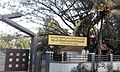
 Feroke bus stand | |
 Feroke Location in Kerala, India | |
| Coordinates: 11°11′0″N 75°51′0″E / 11.18333°N 75.85000°E | |
| Country | |
| State | Kerala |
| District | Kozhikode |
| Taluk | Kozhikode |
| Founded by | Parappanad Royal family |
| Government | |
| • Type | Municipal council |
| Area | |
• Total | 15 km2 (5.8 sq mi) |
| Population (2011) | |
• Total | 54,074 |
| • Density | 3,600/km2 (9,300/sq mi) |
| Languages | |
| • Official | Malayalam, English[1] |
| Time zone | UTC+5:30 (IST) |
| Postal code | 673631 |
| Vehicle registration | KL-85 |
| Lok Sabha constituency | Kozhikode |
| Nearby Railway Station
| Feroke Railway Station
|
Feroke (IPA: [fɐroːkːɨ̆]) is a Municipality in Kozhikode district, Kerala, and part of the Kozhikode metropolitan area. It is 11 km from Kozhikode city and is developing as a suburb, included in the city's urban masterplan.[2][3]

Name
[edit]The village was originally named Farookhabad by Tipu Sultan. Later, this was changed to Feroke by the British. Tipu Sulthan wanted to make Feroke as his capital in Malabar.[4] The remains of a fort built by Tipu Sultan still stands in Feroke with a long tunnel to the river. Authorities are trying to preserve the fort remains as a site of historical importance.[5] The old bridge at Feroke was built by the British in 1883.
History
[edit]Feroke, on the southern bank of Chaliyar river, was adjacent to the kingdom of Parappanad during medieval period.[6] The rulers of Parappanad were vassals to the Zamorin of Calicut.[7] The headquarters of Parappanad Royal family was the coastal town of Parappanangadi in present-day Malappuram district.[8] In the 15th century CE, Parappanad Swaroopam was divided into two - Northern Parappanad (Beypore Swaroopam) and Southern Parappanad (Parappur Swaroopam).[7] Beypore, Cheruvannur, and Panniyankara, on northern bank of Chaliyar, became Northern Parappanad.[6] Kadalundi, Vallikkunnu, and Parappanangadi, on the southern bank of Chaliyar became Southern Parappanad.[6]
It is also known the ruler of the Kingdom of Tanur (Vettathunadu Swaroopam) had assisted the Portuguese to build a fort at the island of Chaliyam, which was a part of Southern Parappanad. It was destroyed during the Battle at Chaliyam fort occurred in 1571.[7] Feroke became a part of the Kingdom of Mysore in the late 18th century CE.[7] Following the Third Anglo-Mysore War and the subsequent Treaty of Seringapatam, Feroke became a part of Malabar District under British Raj.[7] Feroke was included in Eranad Taluk in the Malappuram Revenue Division of Malabar District with its Taluk headquarters at Manjeri.[9][6][10] Following the formation of the state of Kerala in 1956, Feroke became a part of Tirurangadi Revenue block of Tirur Taluk.[8][11] On 16 June 1969, Eranad Taluk, Tirur Taluk, Tirurangadi, and Parappanangadi were transferred to the newly formed Malappuram district.[11] However, three Revenue Villages of Tirur Taluk, namely Feroke, Ramanattukara, and Kadalundi, remained in Kozhikode district, as they were much closer to Kozhikode city centre.[11] However Kadalundi Nagaram beach (where the Kadalundi River flows into Arabian Sea, a part of Vallikkunnu grama panchayat), Tenhipalam, the centre of University of Calicut, and Karippur, the site of Kozhikode International Airport, became parts of Malappuram.[11]
Feroke, Ramanattukara, and Kadalundi are parts of Kozhikode taluk and Kozhikode metropolitan area.[12][13]
Demographics
[edit]| Year | Pop. | ±% |
|---|---|---|
| 1961 | 24,124 | — |
| 1971 | 30,516 | +26.5% |
| 1981 | 37,720 | +23.6% |
| 1991 | 44,494 | +18.0% |
| 2001 | 50,277 | +13.0% |
| 2011 | 54,074 | +7.6% |
| Source: Census of India | ||
As of the 2001 India census,[14] Feroke had a population of 29,504. Males constitute 49% of the population and females 51%. In Feroke, 13% of the population is under 6 years of age.
As of the 2011 India census,[15] Feroke has a population of 32,122 of which 15,596 are males while 16,526 are females.
The population of children ages 0-6 is 3,979 which is 12.39% of the total population of Feroke (CT). In Feroke the female sex ratio is of 1060 against state average of 1084. Moreover, the child sex ratio in Feroke is around 969 compared to the Kerala state average of 964. The literacy rate of Feroke city is 95.99% higher than the state average of 94.00%. In Feroke, male literacy is around 97.67% while the female literacy rate is 94.42%.
Civic Administration
[edit]Feroke Municipality Election 2020
[edit]| S.No.[16] | Party Name | Party symbol | Number of Councillors |
|---|---|---|---|
| 01 | UDF | 20 | |
| 02 | LDF | 17 | |
| 03 | BJP | 01 |
Election results
[edit]
| |||||||||||||||||||||||||||||||||||||
All 38 councils in the Feroke Municipality 20 seats needed for a majority | |||||||||||||||||||||||||||||||||||||
|---|---|---|---|---|---|---|---|---|---|---|---|---|---|---|---|---|---|---|---|---|---|---|---|---|---|---|---|---|---|---|---|---|---|---|---|---|---|
| Turnout | 79.81% | ||||||||||||||||||||||||||||||||||||
| |||||||||||||||||||||||||||||||||||||
| |||||||||||||||||||||||||||||||||||||
Industry
[edit]Feroke is the cradle of the tile industry in Kerala. The rapid rivers from the Western Ghats after passing through forests carry the clay which is the raw-material for tiles, pottery and ceramic wares. There are more than a dozen tile factories in Feroke. Feroke is also well known for its wood and timber industries.
Cheruvannur and Feroke are predominant industrial areas of Kozhikode. A number of tile factories, match factories, timber industries, automobile dealerships, footwear industries, and steel factories are located in Feroke, providing employment to thousands of workers.
Farook College
[edit]Farook College is the biggest educational organization of Feroke area. The college was started in 1948 and enjoys autonomous status from 2015. It is the largest residential post-graduate institution affiliated with the University of Calicut. The college is located on a hillock originally called 'Irumooli Paramba' 5 km from Feroke Railway Station and 16 km from the city of Calicut and at a distance of 16 km from the Calicut Airport. The entire campus comprising the college, its hostels, the staff quarters and its sister concerns covers an area of 70 acres. The entire village is popularly called 'Farook College' and has a post office called Farook College.

Hospitals
[edit]- Koyas Hospital
- Employees' State Insurance Hospital, Feroke
- Red Crescent Hospital, Chungam.
- Shifa hospital, kallampara
- Govt. Taluk Hospital, Chanda Feroke
Education
[edit]Irshadiya College (3 km)
[edit]Irshadiya College[17] is an educational institution located in Paruthippara road. It has a historic experience of nearly four decades in the educational purview of Feroke. Its main peculiarly is that it offers courses in both arts and Islamic studies. Hundreds of students are studying from in and outside of Kerala.
RCCM College (1 km)
[edit]RCCM College[18] is an exclusive educational institution for commerce students located in Cheruvannur.
Karuvanthuruthy
[edit]Karuvanthuruthy is a fishing village near Feroke. It is surrounded on sides with water giving the name 'thiruth' to it. The village is located on the western side of Feroke railway station. The underbridge from Feroke town goes to Karuvanthuruthy town and the Karuvanthuruthy bridge connects the town to Chaliyam beach and seawalk.
-
 Bafaki School
 -
 Kadavath Masjidh
 -
 Commonwealth factory
 -
 Karuvanthuruthy Kadavu


Kadalundi (6 km)
[edit]Kadalundi is one of the oldest towns in Kerala and is an example of the old ports called "thundies". The tidal/mangrove forest on the banks of the Kadalundi river make it a picturesque area. The deltas formed by the Kadalundi river add to the beauty of the place. The town is divided into two by the river— Kadalundi in the Kozhikode district and Kadalundi Nagaram in Malappuram district. Thousands of migratory birds from all over the world gather here starting in November.

Major Landmarks
[edit]- Mananchira, 11 km
- University of Calicut, 9 km
- Farook College, 3 km
- Al-farook College, 3 km
- Medical college Kozhikode, 17 km
- Calicut Airport, 17 km
- Kadalundi Bird Sanctuary 7.4 km
- Beypore Beach, 6 km
Villages and Suburbs
[edit]- Chandakkadavu, Pettah and Chungam
- Karuvanthuruthi, Thirichilangadi and Kokkivalavu
- Adivaram, Melevaram and Irumoolipparamba
- Perumugham and Pullikkadavu.
- Kallampara
- Nallur
- Puttekadu
- Chenaparamba
- Karad
- Feroke Railway Station
Image gallery
[edit]-
Orphanage School
-
Kadavath Masjidh
-
 Feroke Post Office

See also
[edit]- Kadalundi Bird Sanctuary
- Paruthippara
- Farook College
- Ramanattukara
- Cheruvannur
- Karuvanthiruthy
- Kadalundi
- Chelembra
- Cherukavu
References
[edit]- ^ "The Kerala Official Language (Legislation) Act, 1969" (PDF). PRS Legislative Research. Archived from the original on 11 September 2014. Retrieved 19 July 2018.
- ^ "Master plan for Kozhikodeurban area likely to be revised". The Hindu. 13 June 2019. ISSN 0971-751X. Retrieved 23 April 2021.
- ^ "Master Plan | Kozhikode Municipal Corporation". kozhikodecorporation.lsgkerala.gov.in. Retrieved 20 May 2021.
- ^ K. I. Abin (29 June 2014). "Trip tips: Tipu Sultan's dream capital - Feroke". Deccan chronicle. Retrieved 17 August 2020.
- ^ "ഫറോക്കിലെ ടിപ്പു കോട്ടക്ക് പുതുജീവൻ നൽകുമ്പോൾ". islamonlive. 22 November 2020. Retrieved 25 November 2020.
- ^ a b c d Logan, William (2010). Malabar Manual (Volume-I). New Delhi: Asian Educational Services. pp. 631–666. ISBN 9788120604476.
- ^ a b c d e Sreedhara Menon, A. (January 2007). Kerala Charitram (2007 ed.). Kottayam: DC Books. ISBN 9788126415885.
- ^ a b Devassy, M. K. (1965). District Census Handbook (2) - Kozhikode (1961) (PDF). Ernakulam: Government of Kerala.
- ^ 1951 census handbook - Malabar district (PDF). Chennai: Government of Madras. 1953.
- ^ C.A., Innes (1908). Madras District Gazetteers: Malabar and Anjengo. Government Press, Madras.
- ^ a b c d K. Narayanan (1972). District Census Handbook - Malappuram (Part-C) - 1971 (PDF). Thiruvananthapuram: Directorate of Census Operations, Kerala. p. 3.
- ^ Directorate of Census Operations, Kerala. District Census Handbook, Kozhikode (PDF). Thiruvananthapuram: Directorate of Census Operations, Kerala.
- ^ Directorate of Census Operations, Kerala. District Census Handbook, Malappuram (PDF). Thiruvananthapuram: Directorate of Census Operations, Kerala.
- ^ "Census of India 2001: Data from the 2001 Census, including cities, villages and towns (Provisional)". Census Commission of India. Archived from the original on 16 June 2004. Retrieved 1 November 2008.
- ^ "Feroke Population Census 2011 - 2018". census2011.co.in. Retrieved 30 December 2018.
- ^ "Feroke Municipality election 2020". lbtrend. Archived from the original on 9 March 2021. Retrieved 11 December 2020.
- ^ "Irshadiya College - College of Commerce and Social Sciences | Feroke - Calicut | Official Website | Parallel College under Calicut University | University of Calicut Courses". www.irshadiyacollege.com. Retrieved 18 October 2018.
- ^ "RCCM College – Regional college of Commerce and Management | Feroke - Calicut | Official Website | Parallel College under Calicut University | University of Calicut Courses". www.Rccmcollege.com. Retrieved 2 August 2019.
External links
[edit]